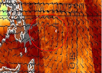
WELCOME TO TYPHOON AND WEATHER IMAGERY. THIS BLOG CONTAINS REAL TIME WEATHER, TROPICAL CYCLONE UPDATES AND IMAGERY, AND TROPICAL CYCLONE FORECAST. CONTENTS OF DROP DOWN MENU CAN BE FOUND AFTER PHILIPPINE IMAGERY BELOW (SCROLL DOWNWARD). THANK YOU VERY MUCH FOR VISITING THIS SITE. YOU ARE FREE TO MAKE ANY COMMENT(S) OR FEEDBACK(S) ABOUT THIS BLOG. MAY 29, 2025 - 10PM SYNOPSIS: Southwesterly Windflow affecting the western section of Luzon and Visayas.

ACTIVE LOW OR TROPICAL CYCLONES

CLICK IMAGERIES TO REDIRECT ON COMPLETE IMAGERIES AND INFORMATIONS (Imageries will be seen after Philippines imagery below)

Ragasa/#NandoPH

LANGUAGE TRANSLATION

PHILIPPINES RADAR COURTESY OF RAINVIEWER THRU PAGASA DOPPLER RADAR


NCR DOPPLER RADAR

PHILIPPINES DOPPLER RADAR
RealEarth


WARM BUT POSSIBLE WET SUMMER LIKELY THIS YEAR

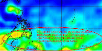
If current sea surface temperature and sea height anomalies including atmospheric condition over Western Pacific won’t change, then a possibility a warmer but wet summer likely to this year over Philippines.

Latest images shows, sea surface temperature along near to equator up to 15N have some rapid build up, as deeper and warmer sea condition also observed along near Marianas island to Philippine sea with increase above 30cm over the area. Convection also persist over near equator to 13N both Western and South China Sea, with some series of small circulation observed for the past 6 weeks.
Vortices also continuously observed at low to moderate level along near equator as shear expected to increase over the area. Upper divergence also expected to reach negative as high pressure expected to dominate along the area.


This indicators supported by images, foresee that more early warmer temperature expected to felt most of the Philippines. Conditions over SST and height anomalies will lead some more moisture availability over above troposphere that could lead to multiple formations of Level 2-5 convection along the area.

Although, this coming March is considered having at least 1 tropical cyclone, A probability of having at least 2-3 before May might happen if to consider the current condition of Western Pacific. Only low shear and low level westerly wind including monsoon trough (ITCZ) are the missing content for tropical cyclogenesis up to this time.
Possibly, areas to have more rains within next 3 months are Mindanao mostly eastern part, Eastern Visayas. Some light to moderate rains might happen along rest of Mindanao and Visayas including Eastern Luzon and Bicol region. Light rain expected to felt over Southern Luzon including Metro Manila, as warmer but probably moist area likely to evolve to March-May.

(FOR TROPICAL CYCLONE FORECAST THIS YEAR, I WILL RELEASE MY OWN OBSERVATION WITHIN 1ST WEEK OF APRIL)

97/98W REMAIN BUT HEADING FOR DISSIPATION

97/98W continue to persist though most of its convection now displaced further away from its LLCC as it concentrated over most of Luzon. As of 2p, it was spotted based on latest wind and vorticity imagery at near west coast of Panay Is or at 11-11.5N, 121.5-122E with SLP of 1010mb and max wind of 15kts.

Convection displacement further to the northeast is due to frontal system already embedded over the area which compete with now fast moving high pressure ridge over North.

Upper divergence further weakens allowing pressure to rise most of the area. Wind shear continues to increase over the area disrupting further the development of convection which now limited to L2-4 only.
All factors now unfavorable for the system and therefore expected to weakens further and eventually to dissipate within 12-24hrs despite wind circulation remain visible.

18mm/hr rainrate expected over Southern Luzon particularly metro manila within next 3-6hrs.

97/98W BISING REMAIN AS SEVERE ALERT THREATHENS VISAYAS

97W renamed as 98W (LOCALLY NAMED BY PAGASA AS BISING), remained at severe alert status based on latest vorticity wind over the area as its convection keeps flaring away from its LLCC, remains its threat at visayas and northern mindanao with moderate to heavy rains. As of 12p, it was centered based on NRL at 7.5N,128E or approximately at 187km east of Mindanao with maximum wind of 15-20kts and SLP of 1008mb.

Recent upper divergence shows some weakness to weak at 10kts with poleward outflow being cut by strong Ridging over to the north which acts as a steering influence over 97/98W (bising).

Convection along the area remain scattered but at level of 4-5 only due to increasing shear over its current position.
The next 12-24hrs are critical to whether 97/98W (bising) survive due to proximity over land and environmental factor slowly becoming unfavourable for the system.

TROPICAL DISTURBANCE SEVERE ALERT BISING(97W) DEVELOPED

97W (BISING IN LOCAL PAGASA NAME), continues to intensify as it convection slowly consolidating over LLCC but not that deep as of the moment due to moderate shear over SW quandrant of the LLCC. As of 10p, it was spotted based on latest vorticity image at 8N, 130E or approximately at 495km east of Surigao, with SLP of 1008 and max windspeed of 15-20kts (28-37kph), that maintain its status as Severe Alert.


Based on latest vortices shows some increase over the area for the past 12hrs and now reaches high status. Upper divergence improved to 20kts which is fair to good with pole ward outflow maintain at fair level. Westerly winds continues to spread most over near equator toward to its circulation indicating the system's circulation improving. It is currently under the steering influence of High over North that steered 97W more to the West.


SST over the area remain very warm at 29-30C with OHC at 90-120kj/cm3. Tropical Disturbance Severe Alert 97W/Bising, expected to slowly intensify as shear expected to relax over the area. It might possibly reaches a minimal depression within 24hrs if all environmental factor remain the same over the area.
Visayas, Northern Mindanao and Bicol region are under watch with Eastern Visayas under Severe Alert for the effect of the said system.

97W SLOWLY ORGANIZING

97W slowly organizing over South of Philippines sea as its convection remain scattered away from its LLCC. As of 1p, it was spotted based on latest vortices at 10.9N, 133.6E with SLP of 1010mb and windspeed of 15kts.
Latest satellite imagery shows convection leveled to 4-5 scattered over the area somewhat affected by recent moderate to High shear placed south of LLCC, however, shear begins to subside for most over its northern quandrant. Upper divergence remain weak at 10kts but very warm SST and moderate OHC over the area help maintain its current condition.
97W forecast to remain as alert due to moderate vortices over the area, shears expected to weakens and might improved its convective clouds within then next 12-24hrs. Winds slowly showing clearer circulation as westerly wind over north of equator begins to wrapped along the area.

95W/96W LASHING VISAYAS ANOTHER TROPICAL DISTURBANCE DEVELOPING

95W/96W continues to lashed visayas with its moderate to blinding rain. As of 5p, the system was spotted at 9.1N, 122.7E or at Southern Part of Negros with SLP of 1012.4mb and max winds of up to 15kts.Latest satellite imagery shows its convection remain scattered over Visayas though its deepness lowered to L5-6. Upper divergence still low at 10kts but shears over the remain at 5-10kts.
The system currently under the steering influence of High pressure ridge over North. 95W/96W still embedded over intensifying near equatorial trough.

The system expected to continue bring moderate to very heavy rains across Visayas and eventualy over Southern Luzon particularly over Mindoro and Palawan.


Meanwhile, as near equatorial trough intensifying another area of concern was spotted at 2-4N, 133-136E. Convection over the area deepens to L4-7. This system is closely monitored as closed circulation enveloped over this area and vortices slowly intensifying. Upper divergence were fair at 20kts.

95W/96W MULTIPLE CONVECTION THREATENS SOUTHERN LUZON AND VISAYAS

95W/96W continues to show some intensification despite of proximity over land as multiple L6-7 convection spread further over Visayas. As of 11p, it was centered at 7.9N, 126.5E or east coast of Mindanao with SLP of 1008mb and windspeed of 15kts. It is currently moving west very slowly.
Upper level divergence remain weak at 10kts but weakening shear at 5-10kts and 20kts low level convergence with warm SST and fair equatorial outflow maintain its steady strength and high level of convection.
The system currently under the steering influence of developing High over China which act as main steering influence for 95/96w. Convection of 95/96W likely to remain at L7 as shears expected to remain low at 5-10kts.Southern Luzon Visayas and Northern Mindanao expected to felt the effect as light to blinding rain expected mostly over Visayas.Flashflood likely over the area.
VORTICITY Percent Pixels Colder than -40°C 850-200 hPa Vertical Shear (kt) Cloud-cleared Water Vapor Brightness Temperature (°C)MSLP (hPa)

HIMAWARI WESTERN PACIFIC IR TEMPERATURE IMAGERY

MY TWEETER

News & Journalism - Top Blogs Philippines
Academics

GOOGLE SEARCH TOPIC

Top Stories - Google News

Blog Archive

REFRESH TO UPDATE