
GEO THERMAL IMAGERY (STATIC) |
GEO VISIBLE LOOP IMAGERY |  GEO REAL TIME THUNDERSTORM/PRECIPITATION IMAGERY LOOP (15 MINUTES) 
|
REAL TIME DVORAK (FOR REALTIME POSITION) movies (CLICK TO ZOOM IN, CTRL CLICK TO ZOOM OUT) |  REAL TIME DVORAK TIME SERIES REAL TIME DVORAK TIME SERIES |
 | REAL TIME HOURLY SURFACE WIND WITH VALUE. CREDIT: VENTUSKY |
REAL TIME WITH VALUE. CREDIT: VENTUSKY |
 JTWC TRACK | ||
COMPUTER MODEL FORECAST | ||
 GFS AND NAVGEM TRACK |  GEFS TRACK |  CMC TRACK |
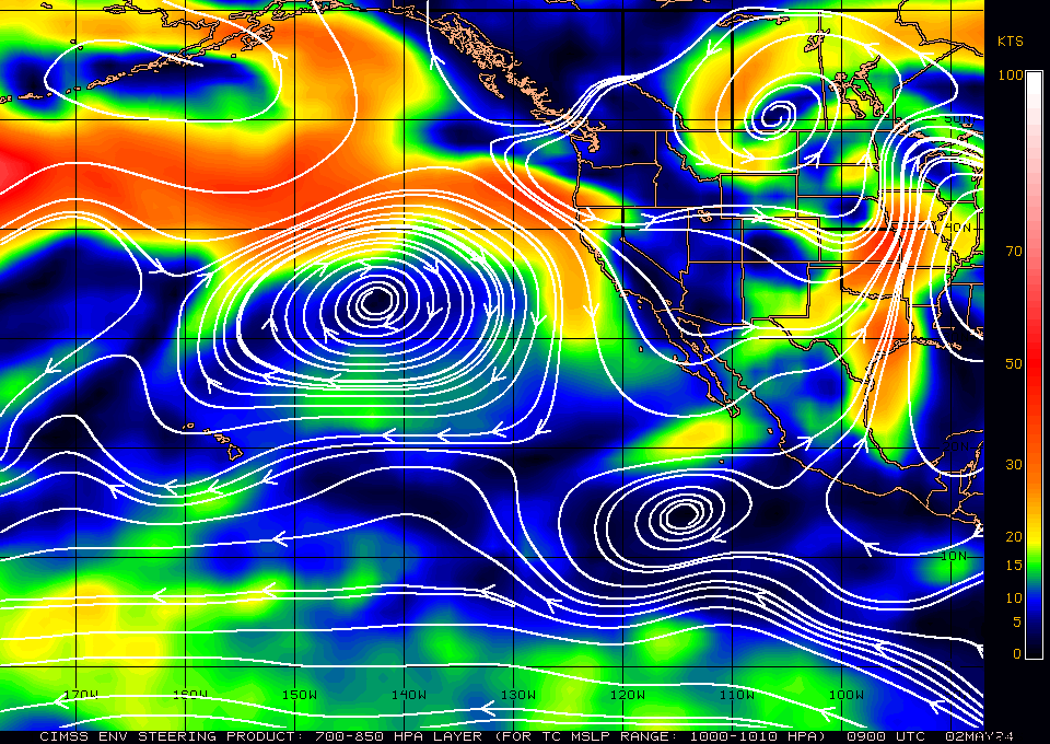 SHALLOW LAYER STEERING | 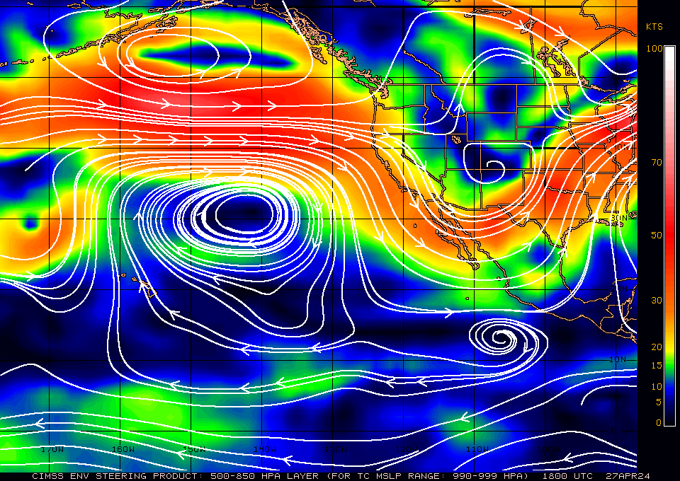 MIDDLE LAYER STEERING | 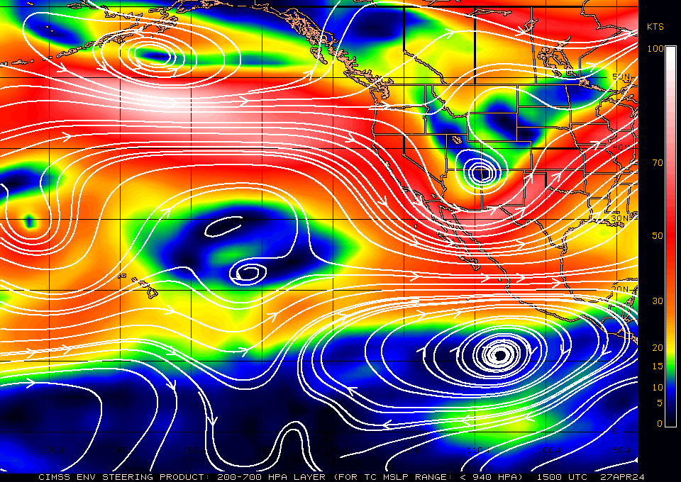 DEEP LAYER STEERING |
STEERING WIND ANALYSIS (CLICK TO ZOOM IN, CTRL CLICK TO ZOOM OUT) |
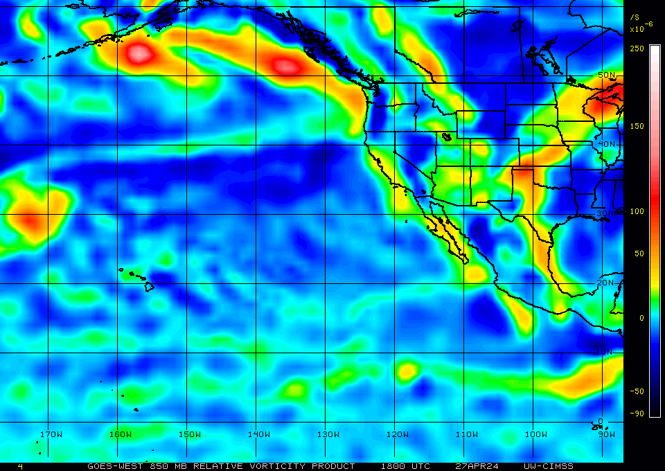 RELATIVE VORTICITY (CLICK TO VIEW LARGER) |  WIND SHEAR AND DIRECTION (CLICK TO VIEW LARGER) |
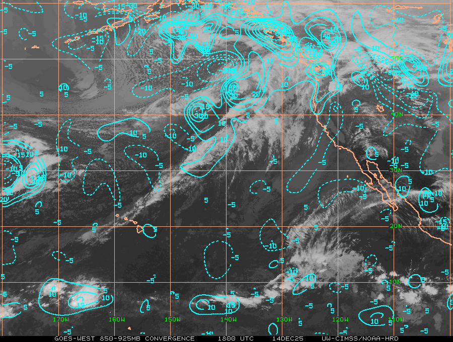 LOW LEVEL CONVERGENCE (CLICK TO VIEW LARGER): To identify potential areas where TC development may occur. Since the development of the TC secondary circulation (low-level inflow, updrafts in the TC eyewall, and upper-level outflow) is essential in the maturation and sustainment of a TC, identification of regions where strong TC convergent inflow near the surface can pinpoint those regions which are in favorable environments | 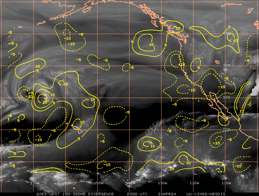 UPPER LEVEL DIVERGENCE (CLICK TO VIEW LARGER): To estimate the strength of the TC secondary circulation, including the low-level inflow into the TC core, the convective updraft strength within the TC eyewall, and the resulting outflow/venting at the top of the TC. This dynamic can be important for storm growth and development |
|
REAL TIME ANIMATION CLOUDTOP - APPROACH |
CLICK LINKS BELOW FOR OTHER REAL TIME (MOST UPDATED) INFORMATIONS
JUST VOTE OR COMMENT FOR FEEDBACK


No comments:
Post a Comment