 09W 6HRS LOCATION AND HOURLY MARINE SURFACE PLOT |
 09W AUTOMATED DVORAK TECHNIQUE POSITION |

HIMAWARI THERMAL IMAGERY (STATIC) | |

HIMAWARI VISIBLE IMAGERY [DAYTIME ONLY(STATIC)] |

HIMAWARI IR IMAGERY [DAY AND NIGHT(STATIC)] |
 HIMAWARI REAL TIME THUNDERSTORM/PRECIPITATION IMAGERY ANIMATION (15/30 MINUTES) 
|
 REAL TIME DVORAK TIME SERIES REAL TIME DVORAK TIME SERIES |
 MICROWAVE IMAGERY (AVAILABLE IF TC IS PRESENT) |
REAL TIME HOURLY SURFACE WIND WITH VALUE. CREDIT: VENTUSKY |
REAL TIME WITH VALUE. CREDIT: VENTUSKY |
 JTWC TRACK |

JMA TRACK | ||
 |
 |
 |
 |
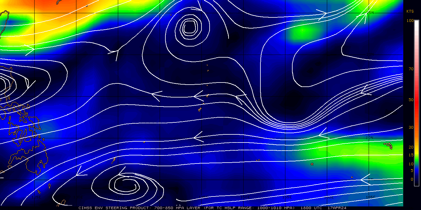 700-850mb LAYER STEERING WIND | 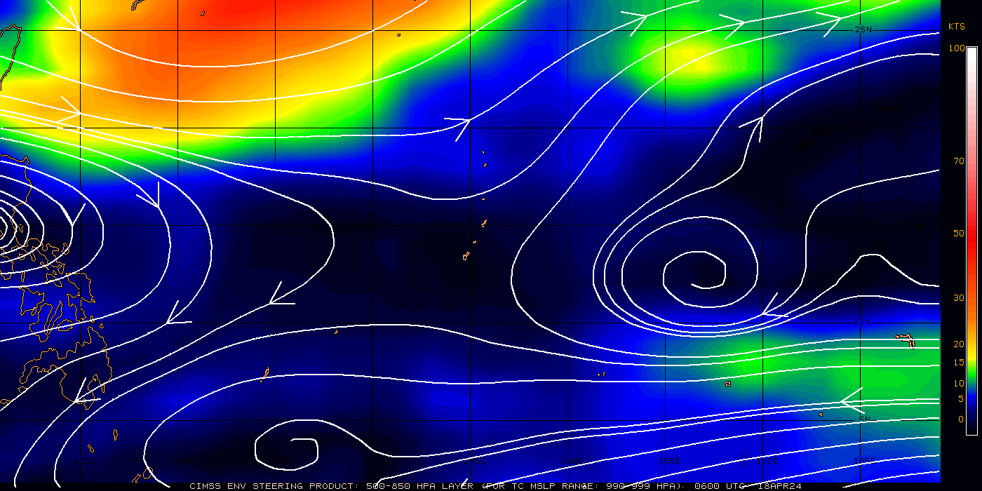 500-850mb LAYER STEERING WIND | 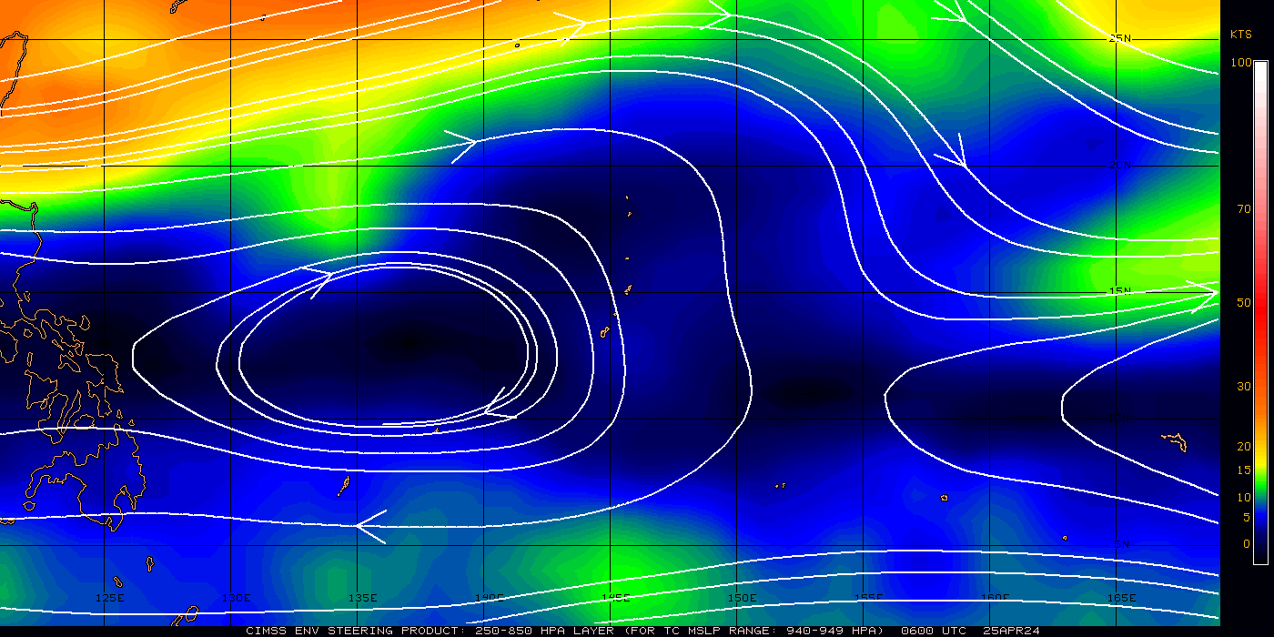 250-850mb LAYER STEERING WIND |
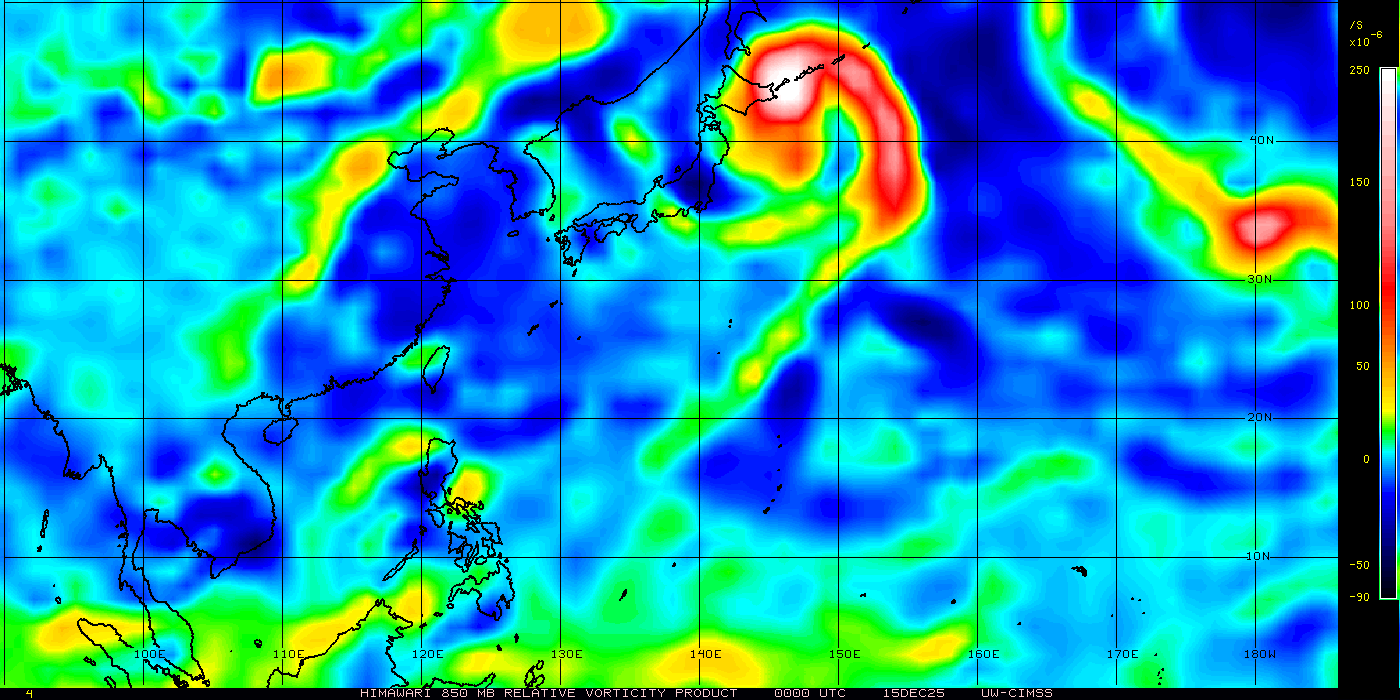 RELATIVE VORTICITY (CLICK TO VIEW LARGER) |  WIND SHEAR AND DIRECTION (CLICK TO VIEW LARGER) |
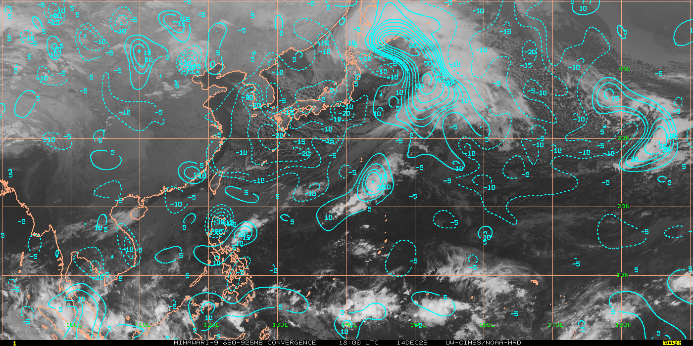 LOW LEVEL CONVERGENCE (CLICK TO VIEW LARGER): To identify potential areas where TC development may occur. Since the development of the TC secondary circulation (low-level inflow, updrafts in the TC eyewall, and upper-level outflow) is essential in the maturation and sustainment of a TC, identification of regions where strong TC convergent inflow near the surface can pinpoint those regions which are in favorable environments |
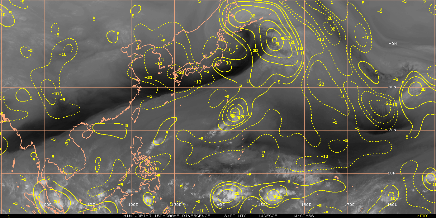 UPPER LEVEL DIVERGENCE (CLICK TO VIEW LARGER): To estimate the strength of the TC secondary circulation, including the low-level inflow into the TC core, the convective updraft strength within the TC eyewall, and the resulting outflow/venting at the top of the TC. This dynamic can be important for storm growth and development |
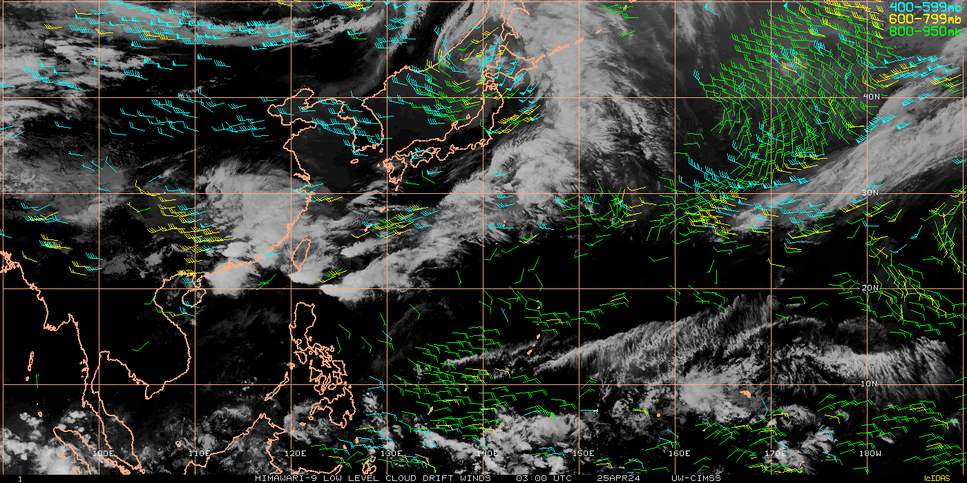 LOW LEVEL WINDS (CLICK TO VIEW LARGER): Mid-level infrared AMVs are utilized to monitor the atmospheric motion in the lower and middle troposphere (above the boundary layer), typically between 500mb and 950mb (explanation of heights) by tracking cloud edges over a sequence of infrared imagery. Low-level rotation of developing tropical waves and mid-level steering currents can be identified by tropical cyclone (TC) forecasters to help determine current atmospheric conditions that could affect TC development, intensity change, and movement | 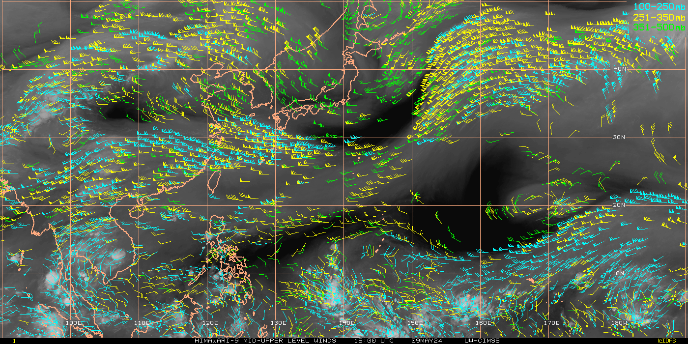 UPPER LEVEL WIND (CLICK TO VIEW LARGER): Upper-level water vapor and infrared AMVs are utilized to monitor the atmospheric motion in the middle and upper troposphere, typically between 100mb and 500mb (explanation of heights). by tracking gradients in a sequence of water vapor imagery and cloud edges in infrared imagery. Jet regions, steering currents, and tropical cyclone (TC) upper-level outflow regions can be identified by TC forecasters to help determine current atmospheric conditions that could affect TC intensity and movement |
CLICK LINKS BELOW FOR OTHER REAL TIME (MOST UPDATED) INFORMATIONS
JUST VOTE OR COMMENT FOR FEEDBACK


No comments:
Post a Comment