⚠ BULLETIN
October 13, 2020 1000AM
TROPICAL DISTURBANCE
CODE/INTERNATIONAL NAME: 94W
LOCAL NAME: N/A
STAGE: WEAK
COORDINATES: 11.7°N, 127.2°E
LOCATION: 185km East of Borongan city, Eastern Samar
DIFFERENT AGENCIES INTENSITY
US (1min aver.): ≤28km/hr
MEAN WINDSPEED: 32.7km/hr
MSLP: 1004mb
Track: WNW at 7km/hr
Rainrate*: ≥35mm/hr
Surface wind analysis: 33.3km/hr (1005.6mb)
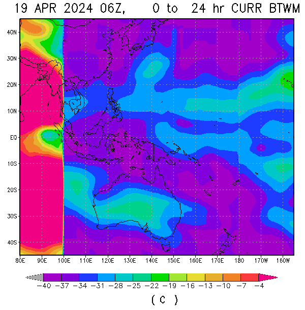
Sea surface Temperature: ≥31°C
Ocean Heat Content: Extreme, influx
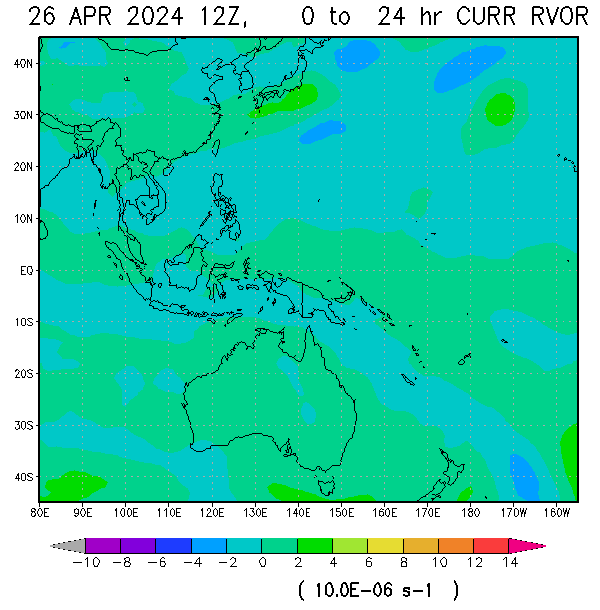
Relative Vorticity: moderate (increasing)
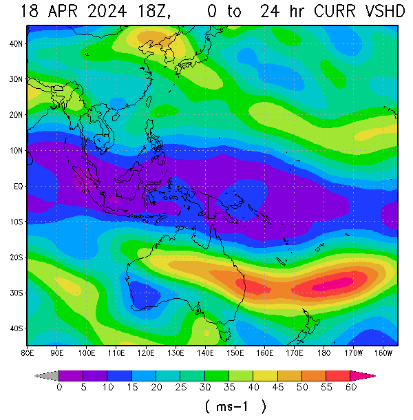
Vertical windshear (average): 7.5kt/13.9km/hr (low, decreasing)
Animated enhanced infrared satellite imagery reveal a broad low level circulation with disorganized flaring convection. Invest 94W is in a favorable environment for development with low vertical wind shear, good equatorward and poleward outflow, and very warm sea surface temperatures with influx of extreme ocean heat content. global models are in some agreement that invest 94W will continue to track WNW and possibly cross either areas of Samar-Bicol area as entry point and transverse over Southern Luzon (either areas of CALABARZON-MIMAROPA-NCR) before consolidating further in the south china sea. Overall the potential for the development of a significant tropical cyclone within the next 36-48 hours islikely.
JUST VOTE OR COMMENT FOR FEEDBACK


No comments:
Post a Comment