WELCOME TO TYPHOON AND WEATHER IMAGERY. THIS BLOG CONTAINS REAL TIME WEATHER, TROPICAL CYCLONE UPDATES AND IMAGERY, AND TROPICAL CYCLONE FORECAST. CONTENTS OF DROP DOWN MENU CAN BE FOUND AFTER PHILIPPINE IMAGERY BELOW (SCROLL DOWNWARD). THANK YOU VERY MUCH FOR VISITING THIS SITE. YOU ARE FREE TO MAKE ANY COMMENT(S) OR FEEDBACK(S) ABOUT THIS BLOG.  SYNOPSIS: Southwest Monsoon affecting Luzon and Visayas.

LANGUAGE TRANSLATION

RealEarth

PHILIPPINES RADAR COURTESY OF RAINVIEWER THRU PAGASA DOPPLER RADAR


NCR DOPPLER RADAR

PHILIPPINES DOPPLER RADAR

Showing posts with label APPROACHING EASTERLY WAVE. Show all posts

EASTERLY WAVE INTENSIFYING, MORE SHOWER OVER MINDANAO EXPECTED

LATEST SATELLITE IMAGERY OVER PHILIPPINES

LATEST CLOSE UP SATELLITE IMAGERY OF CONVECTION

LATEST CLOUD TOP IMAGERY


IMAGES OF THE DAY
(AS OF 3P[05:30UTC] APRIL 08, 2009)
CLICK IMAGES TO SEE CLOSE UP VIEW


NO TROPICAL DISTURBANCE EXISTING AS OF THE MOMENT

SYNOPSIS: DIFFUSED FRONTAL SYSTEM OVER NORTHERN LUZON, EASTERLY WAVE OVER VISAYAS AND MINDANAO.

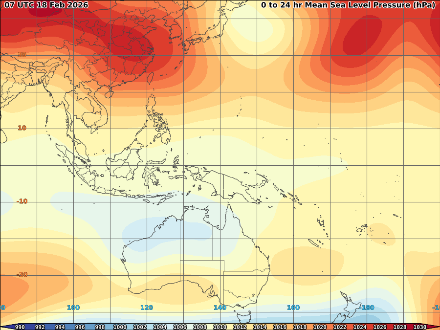
High pressure ridge (1024mb) over Eastern China remain almost stationary slowly becoming a dominant system across Luzon as it now clearing based on latest satellite imagery. Water vapor now slowly diffusing minimizing some possible formation of convection at least for today. Meanwhile, Easterly Wave now intensifying affecting Mindanao and later Eastern Visayas as scattered light-heavy shower or thunderstorm felt for most of the part. It is expected to continue within the day and possibly tomorrow as another L3-6 convection approaches the area at speed of 15kts.
Wind will be at 46kph strong from NE over Northern Luzon because of the said Ridge becoming 28kph from E over the rest of the country.


AREAS MOSTLY PRECIPITATED BASED ON 3BR2RT TRMM IN THE PHILIPPINES


1 DAY
No 30mm/above rainfall
3 DAYS
No 100mm/above rainfall
7 DAYS
219.73mm LEGAZPI/LUZON ISL 13.13 123.73

FRONTAL SYSTEM DIFFUSING, ANOTHER BROAD EASTERLY WAVE APPROACHES

LATEST SATELLITE IMAGERY OVER PHILIPPINES

LATEST CLOSE UP SATELLITE IMAGERY OF CONVECTION

LATEST CLOUD TOP IMAGERY
IMAGES OF THE DAY
(AS OF 3P[05:30UTC] APRIL 08, 2009)
CLICK IMAGES TO SEE CLOSE UP VIEW
NO TROPICAL DISTURBANCE EXISTING AS OF THE MOMENT
SYNOPSIS: DIFFUSED FRONTAL SYSTEM OVER LUZON, APPROACHING EASTERLY WAVE OVER VISAYAS AND MINDANAO.
High presure ridge (1022mb) over Eastern China remain almost stationary maintain though weakens a frontal system over Luzon. Its moisture based at latest WV satellite imagery remain affects most of Luzon thus, some isolated drizzle to light rain still expected over Luzon.
Another broad area of Easterly wave fastly approaching Visayas and Mindanao and expected to bring some scattered to occassional rain over the weekends over the said area. though still far, clear skies remain over Visayas while some isolated light rain expected over Mindanao most of the day today.
Wind remain weakening and now blows at 28kph for most of the country.

AREAS MOSTLY PRECIPITATED BASED ON 3BR2RT TRMM IN THE PHILIPPINES

1 DAY
No 30mm/above rainfall
3 DAYS
No 100mm/above rainfall
7 DAYS
239.26 mm LEGAZPI/LUZON ISL 13.13 123.73

VORTICITY Percent Pixels Colder than -40°C 850-200 hPa Vertical Shear (kt) 850 hPa Horizontal Division (×10-6 s-1)MSLP (hPa)

MY TWEETER

News & Journalism - Top Blogs Philippines
Academics

GOOGLE SEARCH TOPIC

Top Stories - Google News

Blog Archive

REFRESH TO UPDATE