WELCOME TO TYPHOON AND WEATHER IMAGERY. THIS BLOG CONTAINS REAL TIME WEATHER, TROPICAL CYCLONE UPDATES AND IMAGERY, AND TROPICAL CYCLONE FORECAST. CONTENTS OF DROP DOWN MENU CAN BE FOUND AFTER PHILIPPINE IMAGERY BELOW (SCROLL DOWNWARD). THANK YOU VERY MUCH FOR VISITING THIS SITE. YOU ARE FREE TO MAKE ANY COMMENT(S) OR FEEDBACK(S) ABOUT THIS BLOG. As of 4PM APRIL 25, 2024 - SYNOPSIS: WARM EASTERLIES OVER THE COUNTRY

ACTIVE LOW OR TROPICAL CYCLONES

CLICK IMAGERIES TO REDIRECT ON COMPLETE IMAGERIES AND INFORMATIONS (Imageries will be seen after Philippines imagery below)

NO ACTIVE SYSTEM

LANGUAGE TRANSLATION

PHILIPPINES RADAR COURTESY OF RAINVIEWER THRU PAGASA DOPPLER RADAR


NCR DOPPLER RADAR

PHILIPPINES DOPPLER RADAR
RealEarth


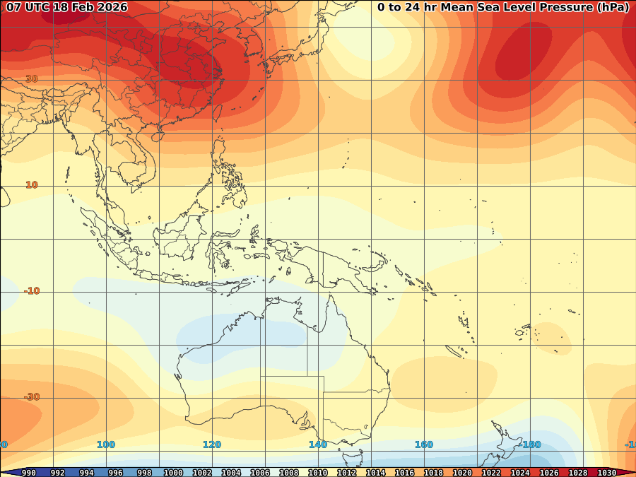
APPROACHING COLDFRONT EASE HOTTER TEMPERATURE WITHIN 2-3 DAYS


This is a welcome development for some areas in Luzon devastated by drought as an approaching coldfront over Northern Luzon will bring colder weather within the next 2-3days with possible rains in some areas. Based on latest imagery today (see above figure), High pressure area over China pushes the said coldfront enhanced by the strong Low pressure system over Japan towards Northern Luzon causing some possible drop of hot temperature to 32-33C. Also, some convective clouds expected to develops as warm moist air expected to convergence over the said cold air which is likely to produce some thunderclouds over portions of Northern Luzon. Though total precipitable water remain below 40mm/hr however, this is the best day for some areas of northern Luzon to have cloudseedling as cloud formations are possible over the said areas.


JUST VOTE OR COMMENT FOR FEEDBACK

No comments:

VORTICITY Percent Pixels Colder than -40°C 850-200 hPa Vertical Shear (kt) Cloud-cleared Water Vapor Brightness Temperature (°C)MSLP (hPa)

HIMAWARI WESTERN PACIFIC IR TEMPERATURE IMAGERY

MY TWEETER

News & Journalism - Top Blogs Philippines
Academics

GOOGLE SEARCH TOPIC

Top Stories - Google News

Blog Archive

REFRESH TO UPDATE