⚠ BULLETIN
October 14, 2020 1200AM
TROPICAL DISTURBANCE
CODE/INTERNATIONAL NAME: 94W
LOCAL NAME: #OfelPH
STAGE: WEAK
COORDINATES: 11.5°N, 126.6°E
LOCATION: 120km East of Borongan city, Eastern Samar
DIFFERENT AGENCIES INTENSITY
US (1min aver.): ≤37km/hr; GUST: No data km/hr
PAGASA (10min aver.): 45km/hr; GUST: 55km/hr
CWB: 43km/hr; GUST: 72km/hr
MEAN WINDSPEED: 47.1km/hr
MSLP: 1004mb
Track: NNW to NW at 10km/hr
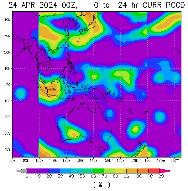
Rainrate*: ≥50mm/hr
Surface wind analysis: 42.6km/hr (1007.6mb)
Sea surface Temperature: 30-31°C
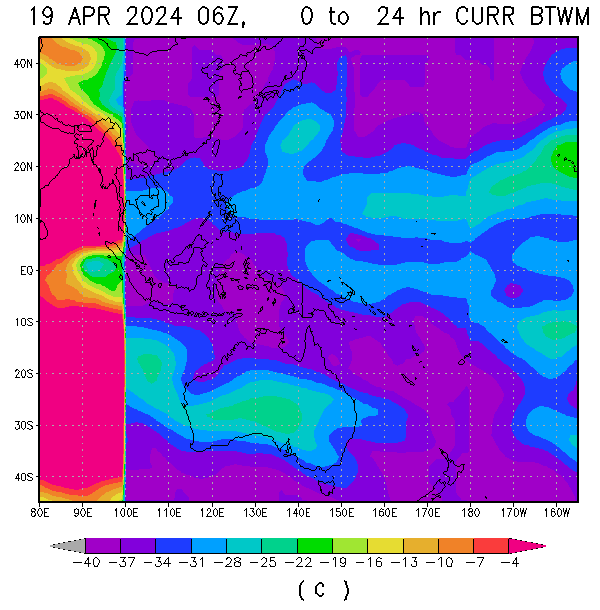
Ocean Heat Content: Very high to extreme, influx
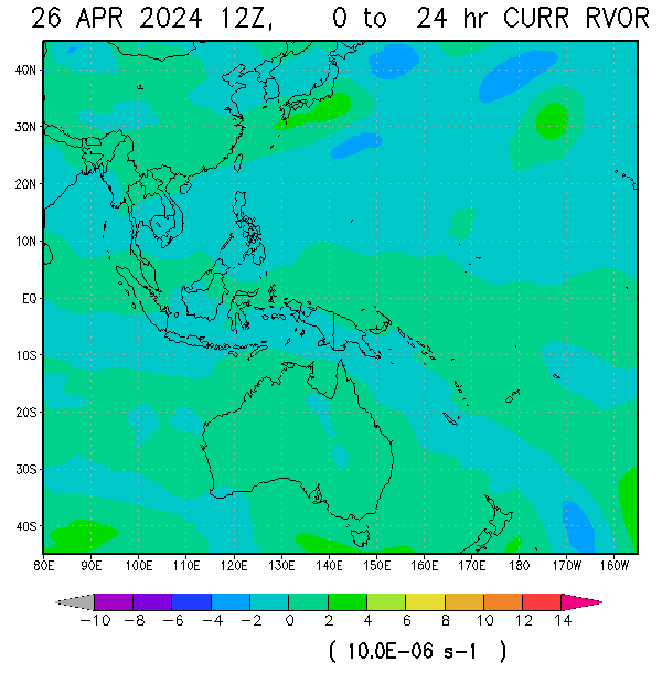
Relative Vorticity: moderate (increasing)
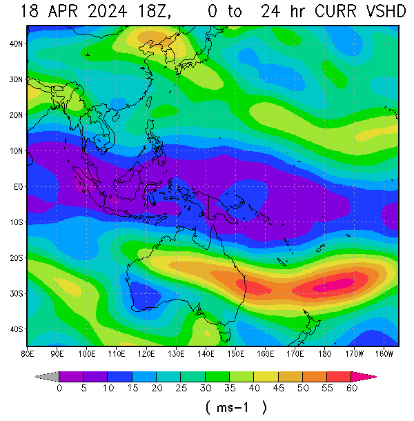
Vertical windshear (average): 7.5kt/13.9km/hr (low, decreasing)
Animated enhanced infrared satellite imagery reveal a broad low level circulation with disorganized, but consolidating flaring convection. Invest 94W remains over at favorable environment for development with low vertical wind shear, good equatorward and poleward outflow, and very warm sea surface temperatures with influx of very high to extreme ocean heat content. Global models rmmains in agreement that invest 94W will continue to track NW to WNW and still possibly cross either areas of Samar-Bicol area as entry point by October 14 and track over Southern Luzon (either areas of CALABARZON-MIMAROPA-NCR) before consolidating further in the south china sea from late October 14-most of October 15. Overall the potential for the development of a significant tropical cyclone within the next 24 hours is likely despite of landfall due to favourable environment across its track.
BASED ON 11PM PAGASA BULLETIN
TCWS 1: The southern portion of Quezon (San Francisco,San Andres,San Narciso, Mulanay,Catanauan, Buenavista, Guinayangan, Tagkawayan, Calauag, Quezon, Alabat, Perez, Atimonan, Unisan, Padre Burgos, Agdangan, Plaridel, Gumaca, Lopez, General Luna, Macalelon, Pitogo) and Burias Islands, Northern Samar, Eastern Samar, Samar, Biliran, and the northern portion of Leyte (Tabango, Leyte, San Isidro, Calubian, Capoocan, Carigara, Jaro, Pastrana, Dagami, Tabontabon, Tanauan, Palo, Santa Fe, Alangalang, Tacloban City, Babatngon, San Miguel, Barugo,Tunga)
For realtime imagery visit the following link below:
Philippines Doppler radar: https://weathergaines.blogspot.com/2012/08/philippines-doppler-radar-noah.html
Nangka/#NikaPH realtime imagery link: https://weathergaines.blogspot.com/2020/10/Tropical-Cyclone-Nangka.html
94W Invest/#OfelPH realtime imagery link: https://weathergaines.blogspot.com/2020/10/Tropical-Disturbance-94W.html
JUST VOTE OR COMMENT FOR FEEDBACK
skip to main |
skip to sidebar


ALL INFORMATIONS AND/OR DATA PUBLISHED ON THIS BLOG ARE SUPPORTED BY ALL WEATHER AGENCIES (SEE BELOW OF THIS BLOG). THIS WAS DONE FOR RECORDS AND USAGE FOR REAL TIME OBSERVATIONS RELEVANT TO TROPICAL CYCLONE INFORMATIONS AND WEATHER UPDATES. KINDLY REFER TO YOUR RESPECTIVE WEATHER AGENCIES FOR UP TO DATE INFORMATIONS. PLEASE REFRESH THIS BLOG TO HAVE AN UP TO DATE SATELLITE IMAGERY.
ACTIVE LOW OR TROPICAL CYCLONES
| CLICK IMAGERIES TO REDIRECT ON COMPLETE IMAGERIES AND INFORMATIONS (Imageries will be seen after Philippines imagery below) | ||||
|
Ragasa/#NandoPH |
||||
LANGUAGE TRANSLATION
Subscribe to:
Post Comments (Atom)
About Me
- TYPHOON AND WEATHER IMAGERY
- City of Las Pinas, National Capital Region, Philippines
- This blogsite is all about different realtime satellite imageries, tropical cyclone information and other weather related topic
FOLLOW THIS SITE
YOU ARE VISITOR NUMBER:
LIVE FEED
Powered by Blogger.


No comments:
Post a Comment