WELCOME TO TYPHOON AND WEATHER IMAGERY. THIS BLOG CONTAINS REAL TIME WEATHER, TROPICAL CYCLONE UPDATES AND IMAGERY, AND TROPICAL CYCLONE FORECAST. CONTENTS OF DROP DOWN MENU CAN BE FOUND AFTER PHILIPPINE IMAGERY BELOW (SCROLL DOWNWARD). THANK YOU VERY MUCH FOR VISITING THIS SITE. YOU ARE FREE TO MAKE ANY COMMENT(S) OR FEEDBACK(S) ABOUT THIS BLOG.  SYNOPSIS: Trough of Tropical Depression (TD) affecting the eastern sections of Visayas and Mindanao.

LANGUAGE TRANSLATION

RealEarth

PHILIPPINES RADAR COURTESY OF RAINVIEWER THRU PAGASA DOPPLER RADAR


NCR DOPPLER RADAR

PHILIPPINES DOPPLER RADAR

Showing posts with label 2010-11 La-nina. Show all posts

98W REMAINS OVER WEST OF BRUNEI, RAIN CONTINUES


  • No tropical cyclone spotted atleast for the next 24hrs.
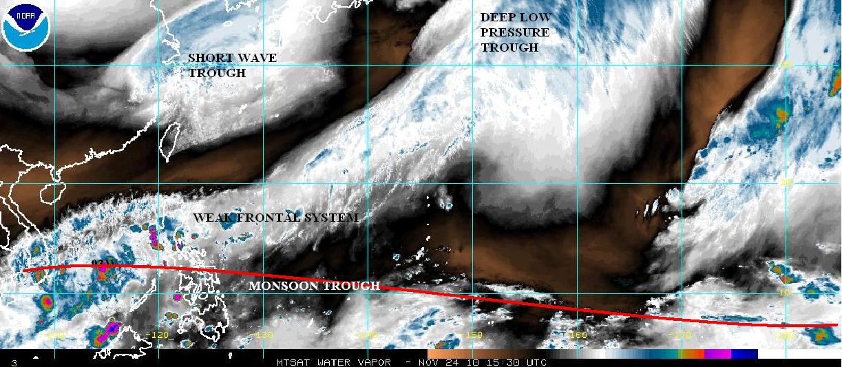
  • Moisture over the country expected to bring enhance rainfall over Southern Luzon, Visayas and Mindanao.
  • Enhance MJO developing over NE of Australia.
  • 98W invest over ENE of Singapore.
  • Overall, Rainfall still expected over Southern Luzon, Visayas and Mindanao probably within the next 3 days.


JUST VOTE OR COMMENT FOR FEEDBACK

DRY AIR EXPANDED BUT ENHANCED DEEP MOISTURE CONTENT MAY TRIGGER 2 MORE DAYS OF RAINFALL


  • Enhanced dry air expanded further over southern china but slowly moving towards Philippines.
  • Enhanced deep moisture remains over much of the Philippines.
  • TPW indicates moisture remains enhance over the country.
  • Overall, rainfall will remain for at least 2 more days


JUST VOTE OR COMMENT FOR FEEDBACK

2010-2011 LA-NINA STRONGER SINCE 1998-2000

1950-1975


1976-2001


2002-present


2010-11 La-Niña keeps getting stronger and possible become strongest since 1988-89 La Niña episodes. Latest Oceanic Nino Index (ONI) seen above, August-October time shows a -1.3˚C SST anomalies, almost double of 2007-08 (-0.7˚C) and even lower of 0.3˚C at 1998-99 (-1.0). As La-Niña matures during winter season, continues drop of ONI expected and possible to duplicate or even stronger compared to 1988-89 episode.

Nearly all models indicate that La Niña (Niño-3.4 SST anomalies -0.5˚C or less) will persist at least into the Northern Hemisphere spring 2011, however, possible strengthening is expected till Northern hemisphere winter.


For more info just visit El-nino/la nina page


Figures Source: NOAA


JUST VOTE OR COMMENT FOR FEEDBACK
VORTICITY Percent Pixels Colder than -40°C 850-200 hPa Vertical Shear (kt) 850 hPa Horizontal Division (×10-6 s-1)MSLP (hPa)

MY TWEETER

News & Journalism - Top Blogs Philippines
Academics

GOOGLE SEARCH TOPIC

Top Stories - Google News

Blog Archive

REFRESH TO UPDATE