WELCOME TO TYPHOON AND WEATHER IMAGERY. THIS BLOG CONTAINS REAL TIME WEATHER, TROPICAL CYCLONE UPDATES AND IMAGERY, AND TROPICAL CYCLONE FORECAST. CONTENTS OF DROP DOWN MENU CAN BE FOUND AFTER PHILIPPINE IMAGERY BELOW (SCROLL DOWNWARD). THANK YOU VERY MUCH FOR VISITING THIS SITE. YOU ARE FREE TO MAKE ANY COMMENT(S) OR FEEDBACK(S) ABOUT THIS BLOG.  SYNOPSIS: Intertropical Convergence Zone (ITCZ) affecting Southern Luzon, Visayas, Mindanao. Easterlies affecting the eastern sections of Northern and Central Luzon. Northeasterly Windflow affecting Extreme Northern Luzon.

LANGUAGE TRANSLATION

RealEarth

PHILIPPINES RADAR COURTESY OF RAINVIEWER THRU PAGASA DOPPLER RADAR


NCR DOPPLER RADAR

PHILIPPINES DOPPLER RADAR

Showing posts with label DECEMBER. Show all posts

TROPICAL DISTURBANCE 99B INVEST 2012

TROPICAL DISTURBANCE 99B INVEST (FOR LATEST POSITION, MOVEMENT AND INTENSITY)

REAL TIME THUNDERSTORM/PRECIPITATION IMAGERY (CLICK TO ZOOM IN, CTRL CLICK TO ZOOM OUT)

-30°C: +2.5mm; -50°C: +5mm; -70°C: +15mm; -85°C: +25mm -95°C: +35mm; -110°C: +50mm

REAL TIME DVORAK (FOR REALTIME POSITION) movies (CLICK TO ZOOM IN, CTRL CLICK TO ZOOM OUT)


REAL TIME THERMAL IR IMAGERY (UPDATED EVERY 30 MINUTES) REAL TIME VISIBLE (UPDATED EVERY 30 MINUTES)
REAL TIME WIND AND IR IMAGERY
REAL TIME DVORAK TIME SERIES
REAL TIME RBTOP IMAGERY (CLICK IMAGERY TO ANIMATE) WUNDERGROUND REAL TIME IMAGERY
FORECAST TRACK>TROPICAL STORM RISK
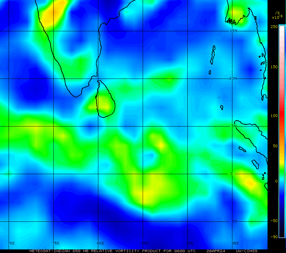
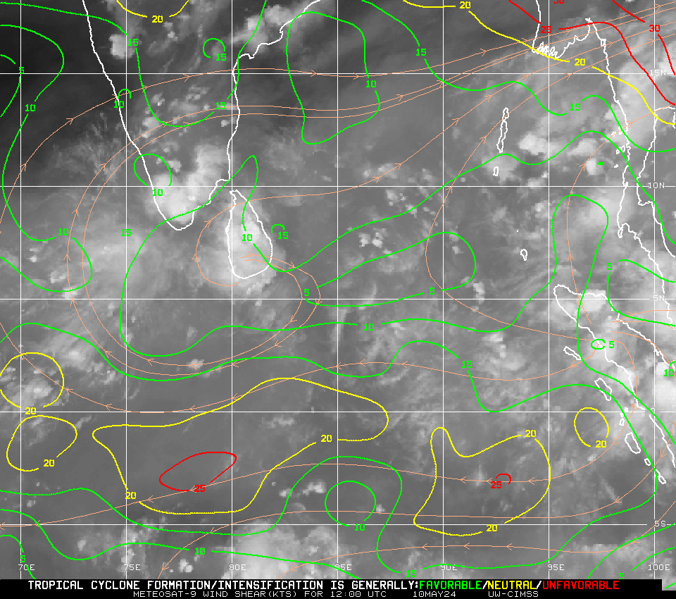
CLOSE UP RELATIVE VORTICITY (CLICK TO VIEW LARGER) CLOSE UP WIND SHEAR AND DIRECTION (CLICK TO VIEW LARGER)
VISIBLE SATELLITE IMAGERY (WITH SUNSHINE ONLY) VISIBLE MODIS IMAGERY (250M ZOOOM)
SATCON AMSU BRIGHTNESS TEMPERATURE SATCON WIND CHART
LOW LEVEL CONVERGENCE (CLICK TO VIEW LARGER): To identify potential areas where TC development may occur. Since the development of the TC secondary circulation (low-level inflow, updrafts in the TC eyewall, and upper-level outflow) is essential in the maturation and sustainment of a TC, identification of regions where strong TC convergent inflow near the surface can pinpoint those regions which are in favorable environmentsUPPER LEVEL DIVERGENCE (CLICK TO VIEW LARGER): To estimate the strength of the TC secondary circulation, including the low-level inflow into the TC core, the convective updraft strength within the TC eyewall, and the resulting outflow/venting at the top of the TC. This dynamic can be important for storm growth and development

STEERING WIND ANALYSIS (CLICK TO ZOOM IN, CTRL CLICK TO ZOOM OUT)
TROPICAL CYCLONE SIGNAL NO: CLICK HERE
CLICK LINKS BELOW FOR OTHER REAL TIME (MOST UPDATED) INFORMATIONS

JUST VOTE OR COMMENT FOR FEEDBACK

WET NEW YEAR'S EVE EXPECTED OVER SOUTHERN LUZON, VISAYAS AND MINDANAO INCLUDING METRO MANILA


  • Enhance to very enhance rainfall over southern luzon, visayas and mindanao.
  • MJO strengthen over south pacific.
  • Overall, wet new years's eve expected over Southern Luzon, Visayas and Mindanao including metro manila.


JUST VOTE OR COMMENT FOR FEEDBACK

98W REMAINS OVER WEST OF BRUNEI, RAIN CONTINUES


  • No tropical cyclone spotted atleast for the next 24hrs.
  • Moisture over the country expected to bring enhance rainfall over Southern Luzon, Visayas and Mindanao.
  • Enhance MJO developing over NE of Australia.
  • 98W invest over ENE of Singapore.
  • Overall, Rainfall still expected over Southern Luzon, Visayas and Mindanao probably within the next 3 days.


JUST VOTE OR COMMENT FOR FEEDBACK

ENHANCE RAINFALL REMAINS OVER PHILIPPINES, TS TASHA OVER NE AUSTRALIA, 92P WILL BE NEXT


  • MJO Weakens
  • Moist air continues to buildup over Philippines
  • Enhance to very enhance rainfall over the Philippines particularly over Southern Luzon, Visayas and Mindanao
  • Tropical storm Tasha over SW of Townsville, NE Australia.
  • Another one in 92P possible to develop


JUST VOTE OR COMMENT FOR FEEDBACK

POSSIBLE RAINY CHRISTMAS OVER THE COUNTRY


  • Enhance to very enhance rainfall over SW Philippines.
  • Suppressed MJO over India.
  • Moist air to very moist air over SW Philippines.
  • Overall, Rainfall expected to continue mostly over SW portion of Philippines (Western Visayas and Western Mindanao including Palawan).
  • Tropical cyclone formation likely over NW Australia this week.


JUST VOTE OR COMMENT FOR FEEDBACK

MJO COMPLETELY WEAKENS, LA-NINA RAINFALL EXPECTED OVER THE COUNTRY


  • Moisture extend over Philippines.
  • Possible enhance rainfall expected
  • MJO weakens further
  • Overall, enhance rainfall associated by La-nina expected to dominates Philippines over the next 2 days.
  • Possible rain expected over Christmas


JUST VOTE OR COMMENT FOR FEEDBACK

98C NOW A TROPICAL STORM FORCE AT 45KT MAX WIND


  • 98C intensified into Tropical storm.
  • Enhance-very enhance rainfall over SW part of Philippines.
  • Dry air remains spreading over most of Pacific
  • MJO weakens further.
  • Overall, rainfall is expected to be more concentrated over SW portion of Philippines with some isolated instances over the rest.


JUST VOTE OR COMMENT FOR FEEDBACK

COLDER AND DRIER AIR OVER LUZON AS COLD FRONT ARRIVES


  • MJO weakens further
  • dry air over Philippines
  • Overall, colder and drier air expected over Luzon as possible enhance rainfall over Mindanao.
  • 91S dissipating over land.

JUST VOTE OR COMMENT FOR FEEDBACK

MJO REGAINING STRENGTH, 91S OVER LAND


  • MJO building back over maritime continent
  • Dry air expanded further over northern Philippines
  • Overall, enhance rainfall over Mindanao
  • 91S already over land NW of Australia


JUST VOTE OR COMMENT FOR FEEDBACK
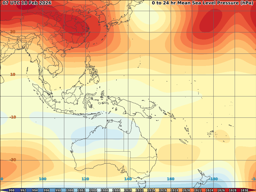
VORTICITY Percent Pixels Colder than -40°C 850-200 hPa Vertical Shear (kt) 850 hPa Horizontal Division (×10-6 s-1)MSLP (hPa)

MY TWEETER

News & Journalism - Top Blogs Philippines
Academics

GOOGLE SEARCH TOPIC

Top Stories - Google News

Blog Archive

REFRESH TO UPDATE