
99W intensified for the past 6hrs and now categorized both JMA and PAGASA as minimal depression. As of 7p, it was centered at 9.7N, 129.0E or at approximately 440km east of Leyte with SLP of 1007.2mb and wind speed of 20-25kts (37-46kph [23kts minimum {43kph}]).

Latest satellite images shows 99w’s convection slowly consolidating with closed circulation based on latest wind analyses. Upper level divergence improved to 20kts with pole ward outflow slowly developing over the area which will allow 99w to have some intensification for the past 6hrs. The system currenly under the influence of strong NE wind over North and Ridge over China
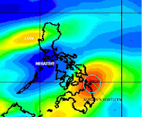
VORTICES

UPPER DIVERGENCE

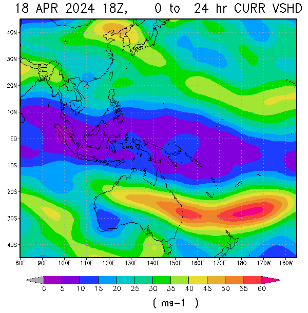
WIND SHEAR

WIND ANALYSES

STEERING WIND

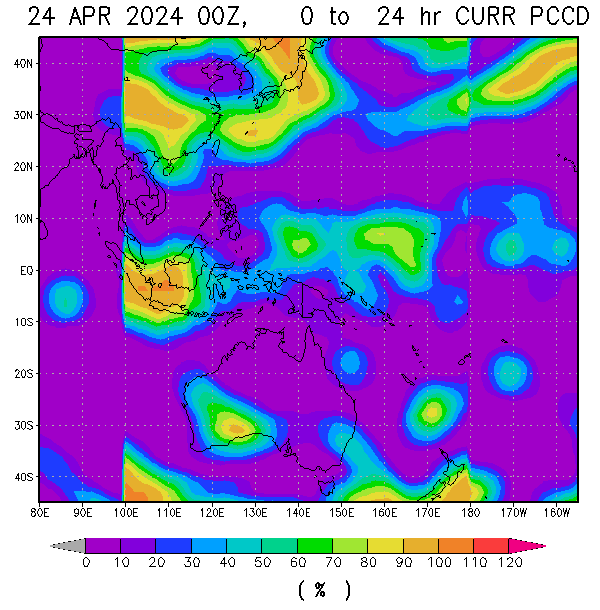
WIND ANALYSES

TROPICAL PRECIPITABLE WATER

RAIN RATE
It is currently moving very slowly to the NNE. The system currently under the steering effect of 2 high over China and Japan and Frontal system currently over SE coast of China extending toward south China sea as it moves further equatorward. The current speed and direction auring primarily affected by this competing systems, however, 80% chances it moves more at pole ward tracts as the said frontal system will capture auring after 24hrs. The chances it may become a minimal storm is uncertain as of this point as colder air surrounds the area, but based on its level of convection, becoming a strong depression possible as plenty of moisture based on TPW and moderate OHC and warm SST supported its amount. Shear remain at low and upper divergence still good wind good pole ward outflow based on water vapour imagery.
up to 10mm/hr rainrate expected over Eastern Visayas and Mindanao.
Rain of up to 7mm/hr expected over the rest of the country mostly Eastern side.
L0 (BLACK) = No clouds with some cloudy
L1 (GRAY) = Cloudy with some overcast
L2 (YELLOW) = Overcast with some drizzle
L3 (BLUE) = Drizzle with some Light Rain/shower
L4 (RED) = Light rain/shower with some Moderate Rain/shower
L5 (PINK) = Moderate Rain/shower with some Heavy rain/shower
L6 (GREEN) = Heavy with some Very Heavy shower
L7 (WHITE) = Very Heavy with some Blinding Rain
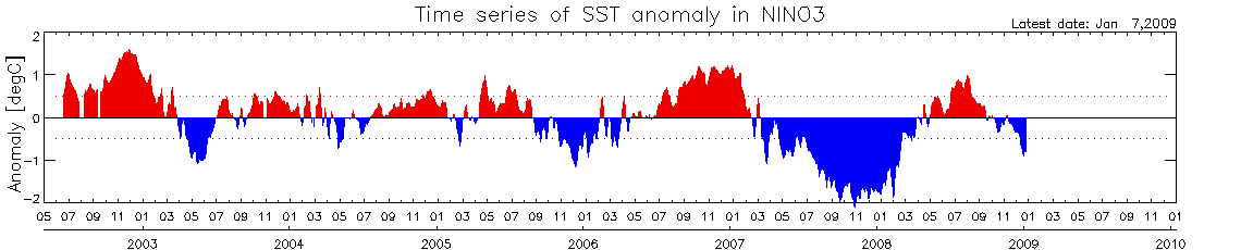
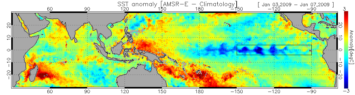
 Some warming of SST were observed most of January following some cooling trends last December. Current SST in the far-eastern Pacific are now back on neutral stage as warming has also been obseved in the Western half of the basin during January. Trade winds accross much of the eastern and central equatorial pacific and the SOI, which though weaker, remain firmly positive.
 Most model outlooks and the eastward propagation of warm sub-surface water from the western equatorial pacific, suggest that the cooler surface condition in the Pacific may not persist beyond summer 2009. Likely scenario is for the central and eastern pacific to warm further over the coming months and to remain neutral.


